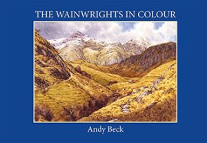
Western Region
UPDATE: 28th January 2024 Due to work commitments progress has been slow with the Lakeland 365 Project but the observant will have noticed some new additions to the listings and images over recent weeks. I am now including two maps (one of which is included below) of the two regions covered by the project. This page covers The Lakeland 365 Western region. To find out more about the way these regions have come about why not read here
Please remember that working on this major list takes time away from my painting and other work. That’s why progress is slow. I hope that you still find the details provided informative.
Most of the fells in The Lakeland 365 Western region are here. Colouration of the symbols is related to the Wainwright Pictorial Guides dustjacket. That is apart from the purple coloured markers. These are most of the “draft” fells which didn’t make the final cut for the guidebooks. Many have yet to have full details and links to pages added but as I say, it is work in progress.
Each fell will eventually have its own page reached via a link where you can find a full description.
Below is a list of the Western Region Fells in table form. Again, work in progress so please bear with me.
If you are viewing this page on a mobile device you may need to turn it into the horizontal to see the whole table below.
Table Headings: Fell name is followed by (AW’s) listing. Height shown is the current measured height. Grid Reference is only 6 figure to give an approximate location of the summit(s). Image is a simple pencil sketch which will eventually be replaced by a watercolour sketch. Star rating is just for fun.
| FELL NAME | Listing | HEIGHT | GRID REF | IMAGE | STAR RATING |
|---|---|---|---|---|---|
| Allen Crags | 1st, 2nd, PG4 | 785m 2575' | NY237 085 | 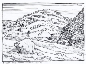 | [usr 2.3] |
| Ard Crags | 1st, 2nd, PG6 | 581m 1806' | NY207 198 | 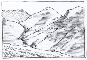 | |
| Armboth Fell* | 1st, 2nd, PG3 | 475m 1558'* | NY296 157 | 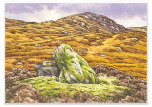 | [usr 1.2] |
| Barf | 1st, 2nd, PG6 | 469m 1539' | NY215 267 | 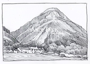 | |
| Barrow* | 1st, 2nd, PG6 | 455m 1493' | NY227 218 | ||
| Base Brown | 1st, 2nd, PG7 | 646m 2119' | NY225 115 | 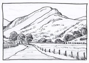 | [usr 2.8] |
| Beacon Fell | OL | 255m 837' | SD278 907 | ||
| Black Combe | OL | 600m 1970' | SD136 855 | ||
| Black Fell | PG4 | 323m 1060' | NY340 016 | ||
| Blake Fell* | 1st, 2nd, PG6 | 573m 1880' | NY111 197 | Awaiting sketch | |
| Blawith Knott | OL | 248m 814' | SD261 884 | ||
| Blea Rigg* | 1st, 2nd, PG3 | 541m 1775' | NY302 078 | 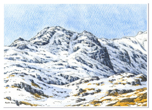 | |
| Bleaberry Fell* | 1st, 2nd, PG3 | 590m 1936' | NY286 196 | ||
| Boat How | 1st, 2nd, OL | 337m 1106' | NY177 034 | ||
| Bow Fell* | 1st,2nd, PG4 | 903m 2962' | NY245 065 | 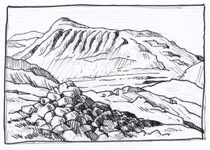 | |
| Brandreth* | 1st, 2nd, PG7 | 714m 2344' | NY215 119 | 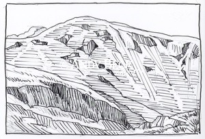 | |
| Brim Fell | 1st, 2nd, PG4 | 796m 2612' | SD271 986 |  | |
| Broad Crag | 1st, 2nd | 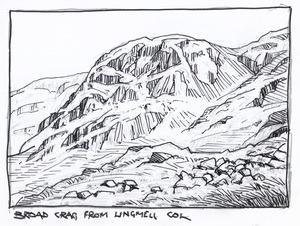 | |||
| Brock Barrow | OL | 229m 751' | SD299 899 | ||
| Broom Fell* | 1st, 2nd, PG6 | 511m 1677' | NY194 272 |  | |
| Brown Pike | 1st, 2nd | 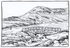 | |||
| Brund-Fell-(Grange-Fell)* | 1st, 2nd, PG3 | 416m 1365' | NY264 162 | 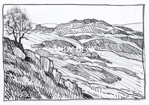 | [usr 2.1] |
| Buck Barrow | OL | 549m 1801' | SD152 910 | ||
| Buckbarrow | PG7 | 423m 1388' | NY136 061 | 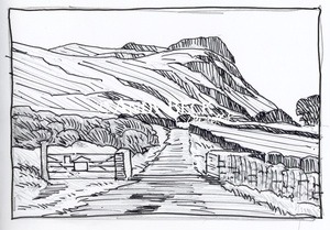 | |
| Burn Moor | OL | 543m 1780' | SD152 924 | ||
| Burnbank Fell | PG7 | 475m 1558' | NY110 210 | Awaiting sketch | |
| Burney | OL | 298m 978' | SD261 859 | ||
| Caermote Hill | OL | 289m 948' | NY196 371 | ||
| Calf Crag | 1st, 2nd, PG3 | 537m 1762' | NY302 104 | ||
| Carling Knott* | 1st, 2nd. | 544m 1785' | NY 117 203 | 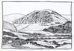 | [usr 1.8] |
| Carron Crag | OL | 314m 1030' | SD325 943 | ||
| Castle Crag | PG6 | 290m 951' | NY249 159 | ||
| Cat Bells | 1st, 2nd, PG6 | 451m 1480' | NY244 199 |  | |
| Causey Pike | 1st, 2nd, PG6 | 637m 2090' | NY219 209 | ||
| Caw | OL | 529m 1735' | SD230 945 | [usr 2] | |
| Caw Fell* | 1st, 2nd PG7 | 697m 2287' | NY132 110 | Awaiting sketch | |
| Claife Heights | OL | 270m 886' | SD382 973 | ||
| Clints Crag | OL | 245m 804' | NY159 352 | ||
| Cold Fell | OL | 293m 961' | NY058 092 |  | |
| Cold Pike | 1st, 2nd, PG4 | 701m 2300' | NY263 036 | ||
| Crag Fell | 1st, 2nd, PG7 | 523m 1716' | NY097 144 |  | |
| Crag Hill (Eel Crag)* | 1st, 2nd, PG6 | 839m 2753' | NY193 203 | ||
| Crinkle Crags | 1st, 2nd, PG4 | 859m 2818' | NY249 049 | 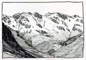 | |
| Cunswick Scar | OL | 207m 679' | SD492 943 | ||
| Dale Head* | 1st, 2nd, PG6 | 753m 2470' | NY223 153 | ||
| Darling Fell | 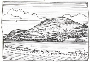 | ||||
| Dent | OL | 352m 1154' | NY037 130 | ||
| Dow Crag | 1st, 2nd, PG4 | 778m 2552' | SD263 978 | ||
| Eagle Crag | 1st, 2nd, PG3 | 525m 1722' | NY275 121 | 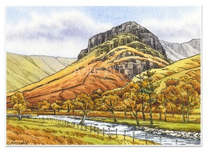 | [usr 2.4] |
| Esk Pike (not named) | 1st, 2nd, PG4 | 885m 2904' | NY237 075 | ||
| Faulds Brow | OL | 344m 1128' | NY299 407 | ||
| Fellbarrow* | PG7 | 415m 1363' | NY132 242 | ||
| Flat Fell | OL | 265m 871' | NY051 138 | ||
| Fleetwith Pike* | 1st, 2nd, PG7 | 649m 2129' | NY206 142 | [usr 3.2] | |
| Gavel Fell* | 1st, 2nd, PG7 | 526m 1726' | NY117 184 | ||
| Gibson Knott* | 1st, 2nd, PG3 | 420m 1378' | NY317 100 | 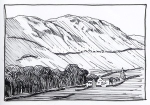 | |
| Glaramara* | 1st, 2nd, PG4 | 783m 2569' | NY246 105 | ||
| Grasmoor | 1st, 2nd, PG6 | 852m 2795' | NY175 204 | ||
| Graystones (Kirk Fell)* | 1st, 2nd, PG6 | 452m 1483' | NY176 266 | ||
| Great Bourne* | 1st, 2nd, PG7 | 616m 2021' | NY124 164 | ||
| Great Carrs | 1st, 2nd, PG4 | 785m 2575' | NY271 009 | 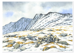 | |
| Great Crag | PG3 | 449m 1473' | NY270 147 | 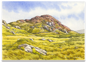 | [usr 2] |
| Great End | 1st, 2nd, PG4 | 910m 2984' | NY227 084 | 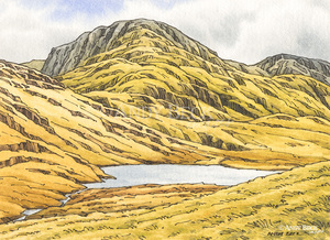 | [usr 3.7] |
| Great Gable | 1st, 2nd, PG7 | 899m 2949' | NY211 103 | 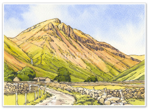 | |
| Great How (Thirlmere) | 1st, 2nd | 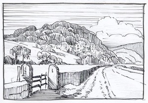 | |||
| Great Saddle Crag | OL | 560m 1837' | NY526 087 | ||
| Great Stickle | OL | 305m 1001' | SD212 916 | ||
| Great Worm Crag | OL | 427m 1400' | SD194 969 | ||
| Green Crag* | 1st, 2nd, PG4 | 489m 1603' | SD200 983 | ||
| Green Gable | 1st, 2nd, PG7 | 801m 2628' | NY215 107 | ||
| Green Pikes | OL | 420m 1378' | SD236 951 | ||
| Grey Friar | 1st, 2nd, PG4 | 773m 2536' | NY260 004 | ||
| Grey Knotts* | 1st, 2nd, PG7 | 697m 2287' | NY219 126 | ||
| Grike | PG7 | 488m 1601' | NY085 141 | ||
| Grisedale Pike | 1st, 2nd, PG6 | 791m 2595' | NY198 225 | 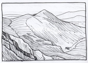 | |
| Harrison Stickle | 1st, 2nd, PG3 | 736m 2415'. | NY282 074 |  | |
| Harter Fell (Eskdale) | 1st, 2nd, PG4 | 654m 2146' | SD219 997 | ||
| Hay Stacks* | 1st, 2nd, PG7 | 595m 1952' | NY193 132 | 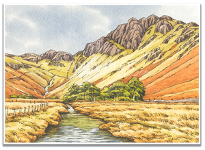 | |
| Haycock* | 1st, 2nd PG7 | 797m 2615' | NY145 107 | ||
| Helm Crag | 1st, 2nd, PG3 | 405m 1329' | NY327 093 | 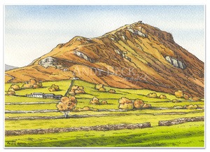 | |
| Hen Comb | 1st, 2nd, PG7 | 509m 1670' | NY132 181 | [usr 1.5] | |
| Hesk Fell | OL | 477m 1565' | SD176 947 | ||
| High Crag | 1st, 2nd, PG7 | 744m 2441' | NY180 140 | ||
| High Light Haw | OL | 263m 862' | SD303 905 | ||
| High Raise (Central)* | 1st, 2nd, PG3 | 762m 2500' | NY281 095 | ||
| High Seat* | 1st, 2nd, PG3 | 608m 1995' | NY287 180 | ||
| High Spy | 1st, 2nd, PG6 | 653m 2143' | NY234 162 | ||
| High Stile* | 1st, 2nd, PG7 | 806m 2644' | NY170 148 |  | |
| High Tove | 1st, 2nd, PG3 | 515m 1690' | NY289 165 | ||
| Hindscarth | 1st, 2nd, PG6 | 727m 2385' | NY216 165 | 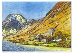 | |
| Holme Fell* | PG4 | 317m 1038' | NY315 007 | ||
| Hopegill Head | 1st, 2nd, PG6 | 770m 2526' | NY186 222 | 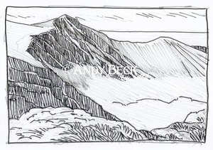 | |
| Howes | OL | 583m 1913' | NY498 104 | ||
| Hull How | 1st, 2nd | 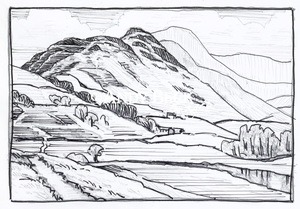 | |||
| Hugh's Laithes Pike | OL | 419m 1375' | NY502 152 | ||
| Illgill Head* | 1st, 2nd, PG4 | 609m 1998' | NY169 049 | ||
| Irton Pike | OL | 229m 751' | NY121 015 | ||
| King’s How | 1st, 2nd, PG3 | 392m 1286' | NY258 167 | ||
| Kinmont Buck Barrow | Ol | 535m 1754' | SD147 910 | ||
| Kirk Fell | 1st, 2nd, PG7 | 802m 2631' | NY195 105 | ||
| Knott Rigg | 1st, 2nd, PG6 | 556m 1824' | NY197 189 | ||
| Knott, The (Lickle) | OL | 284m 932' | SD224 919 | ||
| Knott, The (Stainton Fell) | OL | 331m 1086' | SD144 952 | ||
| Lank Rigg | PG7 | 541m 1775' | NY092 120 | ||
| Latterbarrow | OL | 244m 801' | SD367 991 | ||
| Ling Fell* | 1st, 2nd, PG6 | 373m 1224' | NY180 285 | 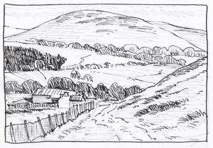 | |
| Lingmell* | 1st, 2nd, PG4 | 807m 2648' | NY209 082 |  | |
| Lingmoor Fell* | 1st, 2nd, PG4 | 469m 1539' | NY303 046 | ||
| Little Yarlside | OL | 516m 1691' | NY532 071 | ||
| Loft Crag | PG3 | 680m 2231' | NY277 071 | ||
| Lords Seat* | 1st, 2nd, PG6 | 552m 1811' | NY204 266 | ||
| Lord's Seat (High House Fell) | OL | 524m 1719' | NY519 066 | ||
| Loughrigg Fell* | 1st, 2nd, PG3 | 335m 1099' | NY347 051 | 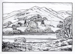 | |
| Low Fell* | 1st, 2nd, PG7 | 423m 1388' | NY137 226 | 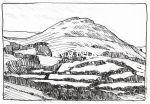 | |
| Low Light Haw | OL | 250m 820' | SD302 901 | ||
| Maiden Moor* | 1st, 2nd, PG6 | 575m 1886' | NY237 182 | ||
| Mellbreak* | 1st, 2nd, PG7 | 512m 1680' | NY148 186 | 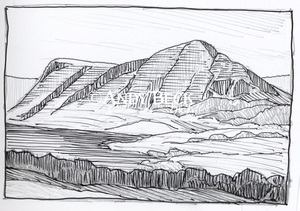 | |
| Middle Fell | 1st, 2nd, PG7 | 582m 1909' | NY151 072 | ||
| Muncaster Fell (Hooker Crag) | OL | 231m 758' | SD112 983 | ||
| Outerside | 1st, 2nd, PG6 | 568m 1864' | NY211 215 |  | |
| Pavey Ark | 1st, 2nd, PG3 | 700m 2297' | NY285 079 | 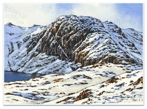 | |
| Pike of Blisco | 1st, 2nd, PG4 | 705m 2313' | NY271 042 | ||
| Pike of Stickle | 1st, 2nd, PG3 | 703m 2326' | NY274 074 | ||
| Pike, The | OL | 370m 1214' | SD186 934 | ||
| Pikes | OL | 469m 1539' | SD238 947 | ||
| Pillar | 1st, 2nd, PG7 | 892m 2927' | NY171 121 | ||
| Ponsonby Fell | OL | 311m 1020' | NY082 070 | ||
| Rannerdale Knotts* | 1st, 2nd, PG6 | 355m 1165' | NY167 183 | 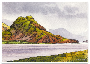 | [usr 1.7] |
| Raven Crag | 1st, 2nd, PG3 | 461m 1512' | NY303 188 | ||
| Red Pike (Buttermere)* | 1st, 2nd, PG7 | 755m 2477' | NY161 155 | ||
| Robinson | 1st, 2nd, PG6 | 737m 2418' | NY202 169 | 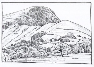 | |
| Red Pike (Wasdale) | 1st, 2nd, PG7 | 826m 2710' | NY165 106 | 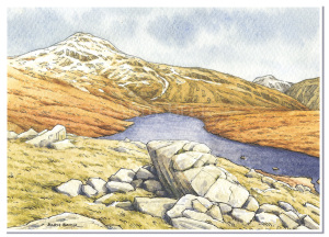 | |
| Rossett Pike* | 1st, 2nd, PG4 | 651m 2136' | NY249 076 | ||
| Rosthwaite Fell/Bessyboot | 1st, 2nd, PG4 | 551m 1808' | NY258 125 |  | |
| Rough Crag (Birker Moor) | OL | 319m 1047' | SD161 978 | ||
| Sail* | 1st, 2nd, PG6 | 773m 2536' | NY198 203 | ||
| Sale Fell | 1st, 2nd, PG6 | 359m 1178' | NY194 297 | 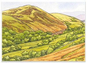 | |
| Scafell | 1st, 2nd, PG4 | 964m 3162' | NY207 065 | 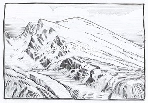 | |
| Scafell Pike | 1st, 2nd, PG4 | 978m 3209' | NY215 072 |  | |
| Scar Crags | 1st, 2nd, PG6 | 672m 2205' | NY207 206 | ||
| Scoat Fell* | 1st, 2nd, PG7 | 841m 2759' | NY159 114 | ||
| Scout Scar | OL | 233m 764' | SD487 920 | ||
| Seat How (Birker Moor) | OL | 311m 1020' | SD165 971 | ||
| Seat Robert | OL | 515m 1690' | NY526 114 | ||
| Seatallan* | 1st, 2nd, PG7 | 691m 2266' | NY 140 084 | [usr 2.2] | |
| Seathwaite Fell* | 1st, 2nd, PG4 | 601m 1972' | NY229 102 | ||
| Sergeant Man | 1st, 2nd, PG3 | 736m 2415'. | NY286 089 | ||
| Sergeant's Crag* | 1st, 2nd, PG3 | 571m 1873' | NY273 114 | 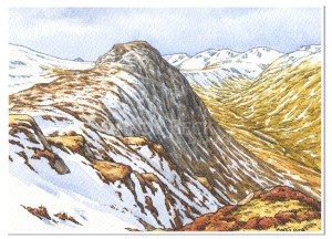 | |
| Setmurthy Common | OL | 254m 833' | NY159 318 | ||
| Side Pike | 1st, 2nd | 362m 1188' | NY293 053 | 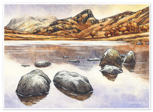 | |
| Silver How | 1st, 2nd PG3 | 395m 1296' | NY325 066 | ||
| Slight Side | 1st, 2nd, PG4 | 762m 2500' | NY210 050 | ||
| St. John's Hill | OL | 285m 935' | NY196 377 | ||
| Stainton Pike | OL | 498m 1632' | SD153 943 | ||
| Starling Dodd | 1st, 2nd, PG7 | 633m 2077' | NY142 157 | ||
| Steel Fell | 1st, 2nd, PG3 | 553m 1814' | NY319 112 | ||
| Steeple* | 1st, 2nd, PG7 | 819m 2687' | NY158 117 | ||
| Stickle Pike | OL | 375m 1230' | SD212 928 | 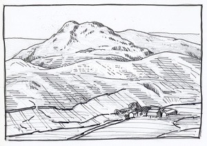 | [usr 2] |
| Stoupdale Head | OL | 472m 1549' | SD151 874 | ||
| Swirl How | 1st, 2nd, PG4 | 802m 2631' | NY273 006 | ||
| Tarn Crag (Easedale) | PG3 | 549m 1801' | NY304 093 | 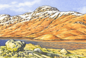 | |
| Tarn Hill | OL | 313m 1027' | SD210 921 | ||
| The Old Man of Coniston | 1st,2nd, PG3 | 803m 2635' | SD272 978 | 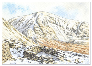 | |
| Thunacar Knott* | 1st, 2nd, PG3 | 717m 2351' | NY279 081 | ||
| Todd Fell | OL | 401m 1316' | NY512 021 | ||
| Top O' Selside | OL | 334m 1096' | SD308 919 | ||
| Tottlebank Height | OL | 236m 775' | SD269 885 | ||
| Ullscarf | 1st, 2nd, PG3 | 726m 2382' | NY292 122 | ||
| Walla Crag* | 1st, 2nd, PG3 | 379m 1243' | NY277 213 | ||
| Walna Scar | 1st, 2nd, OL | 621m 2037' | SD258 963 | 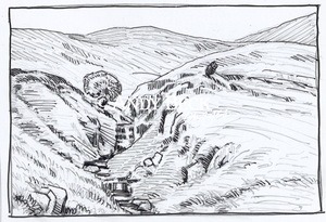 | |
| Wandope | 1st, 2nd PG6 | 772m 2533' | NY188 197 | ||
| Watch Hill | OL | 235m 770' | NY150 319 | ||
| Water Crag | OL | 305m 1001' | SD154 974 | ||
| Wetherlam | 1st, 2nd, PG4 | 763m 2503' | NY288 011 | ||
| Whin Rigg* | 1st, 2nd, PG4 | 537m 1762' | NY151 035 | ||
| Whinlatter (Brown How)* | 1st, 2nd, PG6 | 517m 1696' | NY191 251 | ||
| Whit Fell (Whitfell) | OL | 573m 1881' | SD159 930 | ||
| White Combe | OL | 417m 1368' | SD155 863 | ||
| White Howe (Bannisdale) | OL | 530m 1739' | NY524 042 | ||
| White Pike | OL | 442m 1450' | SD151 956 | ||
| Whiteless Pike* | 1st, 2nd, PG6 | 660m 2165' | NY180 190 | ||
| Whiteside | 1st, 2nd, PG6 | 707m 2320' | NY170 219 | ||
| Whiteside Pike | OL | 397m 1302' | NY521 015 | ||
| Woodend Height | OL | 487m 1597' | SD157 954 | ||
| Wool Knott | OL | 222m 730' | SD273 896 | ||
| Yew Bank | OL | 207m 679' | SD263 910 | ||
| Yewbarrow | 1st, 2nd, PG7 | 627m 2057' | NY173 085 | [usr 3.7] | |
| Yoadcastle | OL | 494m 1621' | SD157 952 | ||