Parking: There are various options for parking in Mungrisdale village. On entering the village from the direction of the A66 there is a layby on the left GR: NY 3645 3004 What Three Words ///thumbnail.output.difficult . This has limited space for about 4 or 5 cars and is free. Further along on the right is the village hall where parking can be had with donations made in an honesty box. GR: NY 36371 30244 What Three Words ///thrusters.awaiting.silently
Refreshments:The Mill Inn Mungrisdale provides food, drink and accommodation. There is a tea garden in the village- Lorraine’s, check her Facebook page for times of opening etc.
Introduction: As part of my Wainwrights in Colour project where I was painting the Wainwrights, all 214 of them, I devised a walk that would enable me to tick off a couple of references photographs for future sketches. This adventure would take in not only 5 Wainwright Fells but also Sharp Edge on Blencathra and Mungrisdale Common. These two features of Lakeland have their own reputations at either end of the “excitement” spectrum.
A note on the sketches. The sketches shown in this blog are all from the Wainwrights in Colour project and book. You will see that Andy interprets the reference photographs to enhance the colours etc where he feels that it is needed. That’s what all artists do. Wainwright himself often used artistic license in his pen and ink drawings, including often compressing the scenes (generally in width) to fit the shape of the Pictorial Guides. As a size comparison, Andy’s original sketches were scaled twice the width and height of the illustrations in the Pictorial Guide.
Route map: click on the arrow to play the route. Route files in various formats such as GPS are available to download by clicking in the Plotaroute.com link at the bottom right.
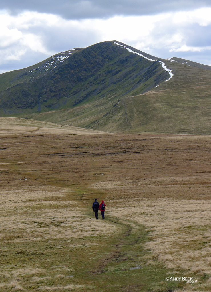
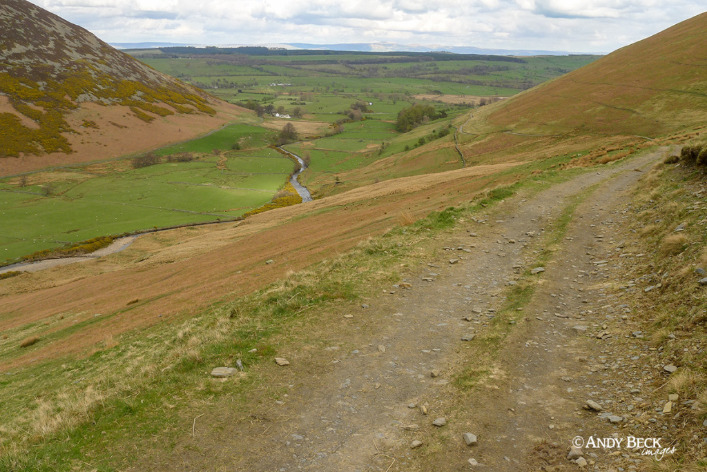
After parking up in Mungrisdale village we headed up the slopes of Souther Fell.
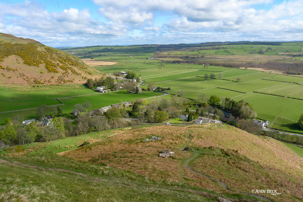
Looking back down at the village. There is no direct public footpath up this slope from Mungrisdale, you have to do a bit of a diversion (shown on the route map above) to gain height.
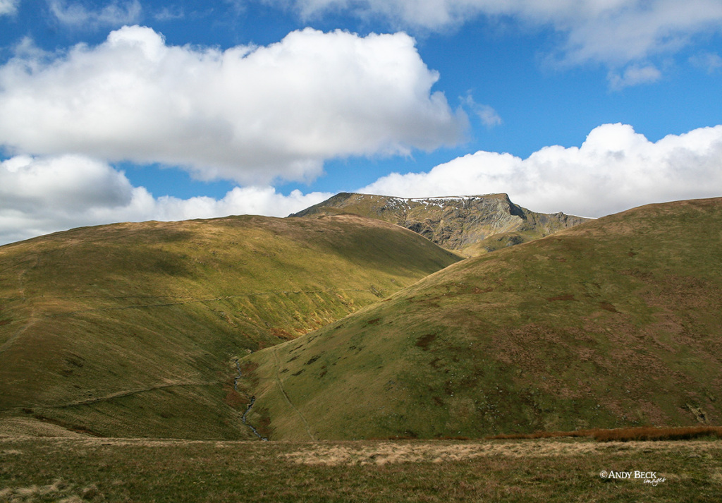
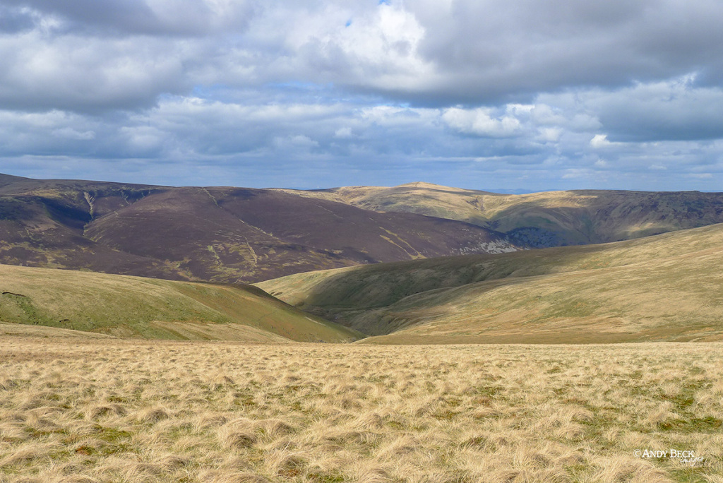
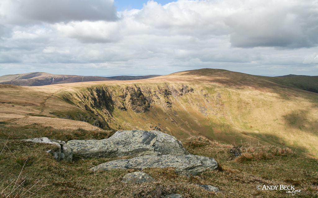
As we nearly reach the summit plateau of the fell there is a great view of Bannerdale Crags and Blencathra.
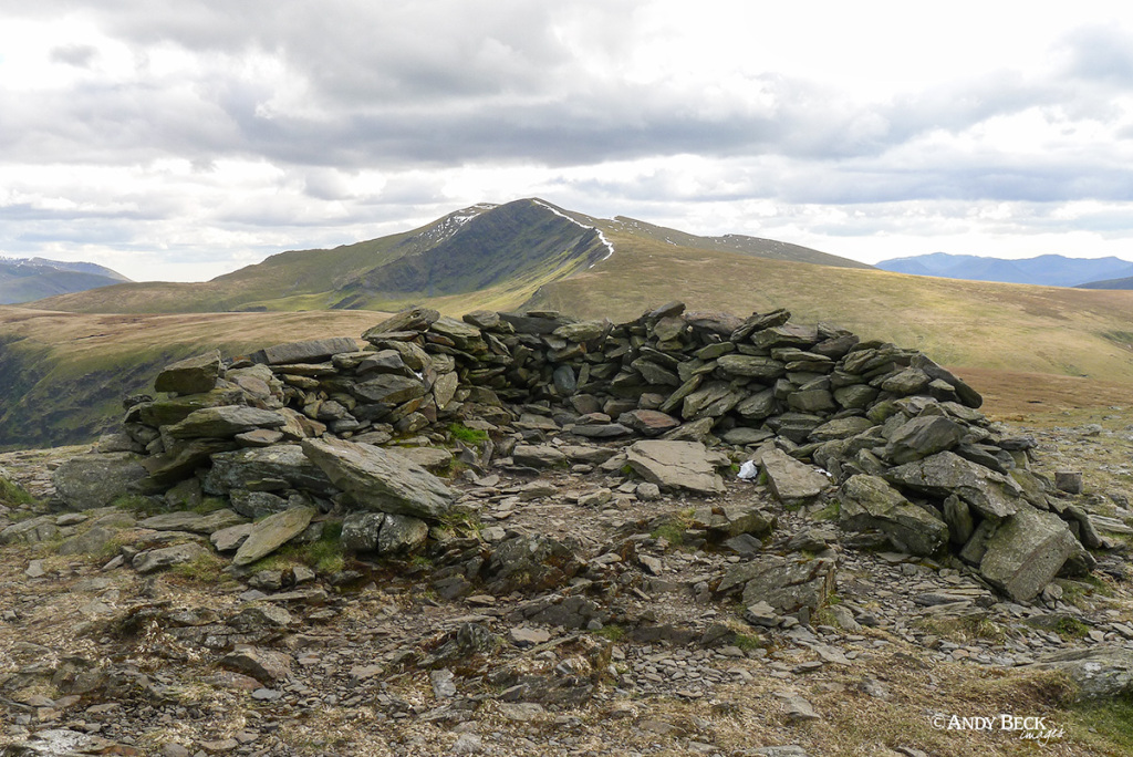
The Wainwright and true summit of Souther Fell. Mostly just an exposed area of bedrock. No real cairn to speak of.
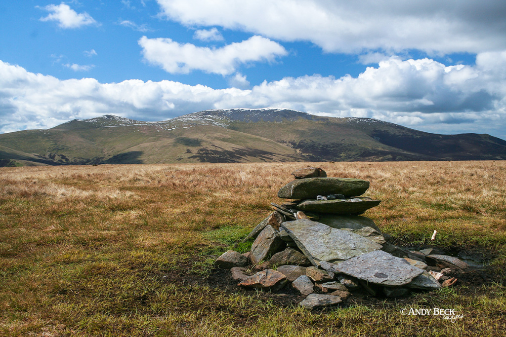
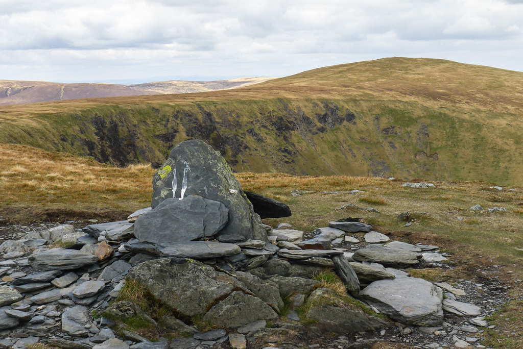
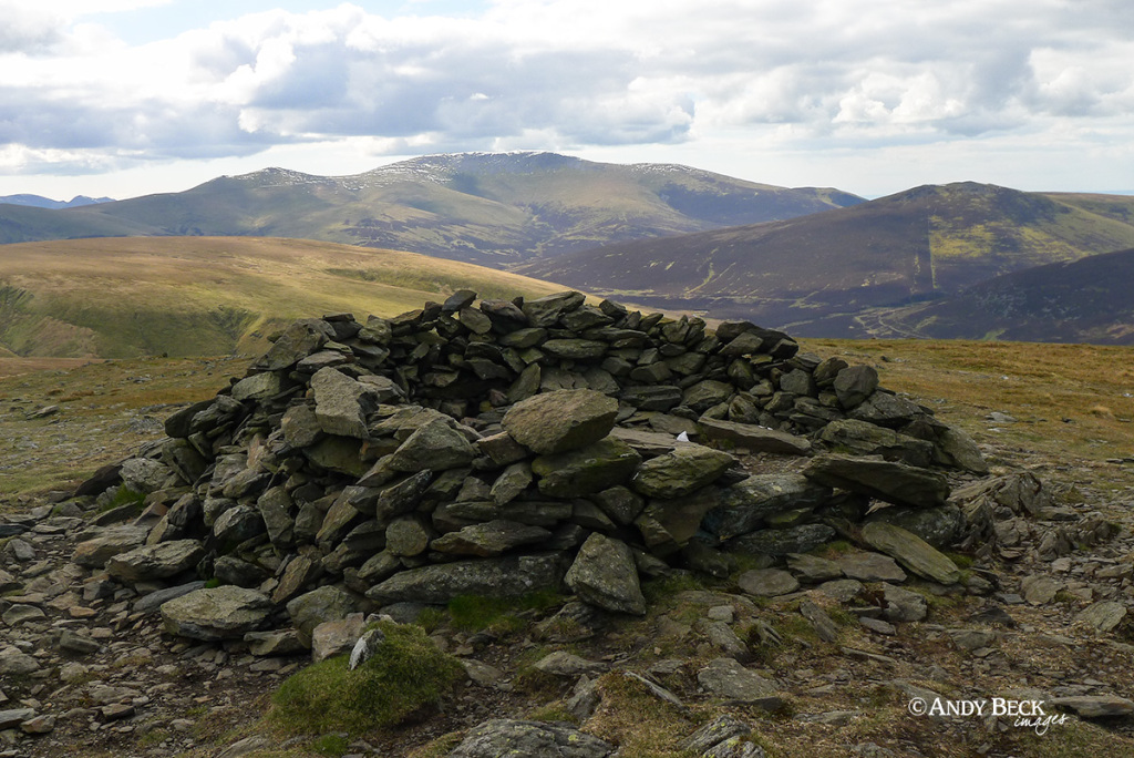
Moving south west along the fell top you will see this substantial cairn off to one side of the main path. Most likely an old shepherd’s cairn it is the most prominent feature hereabouts.
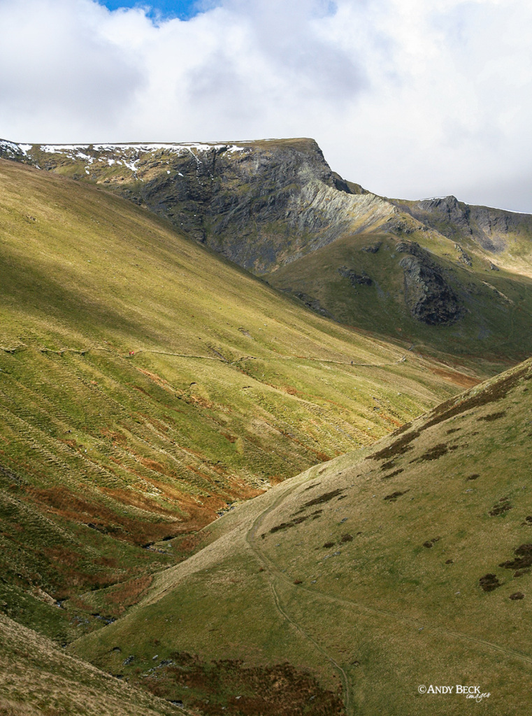
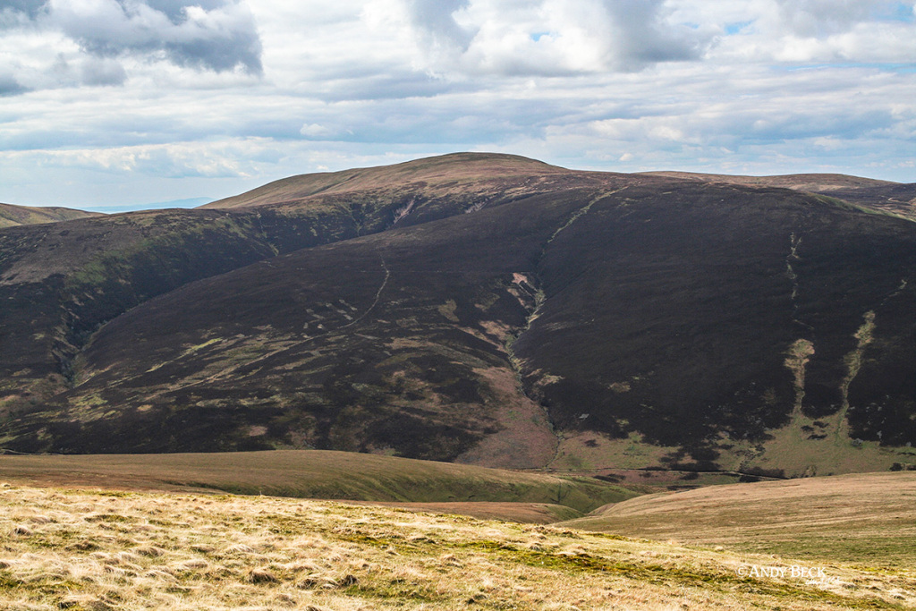
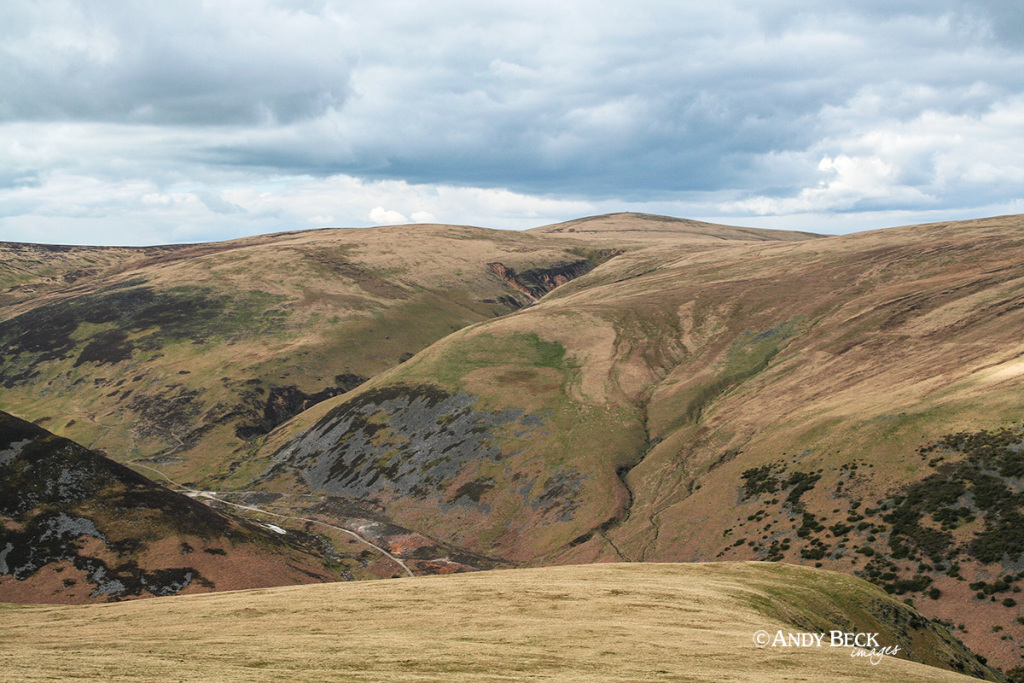
We proceeded on towards Mousthwaite Col (AW) and our eye kept getting drawn to our imminent challenge above the Glenderamackin valley.
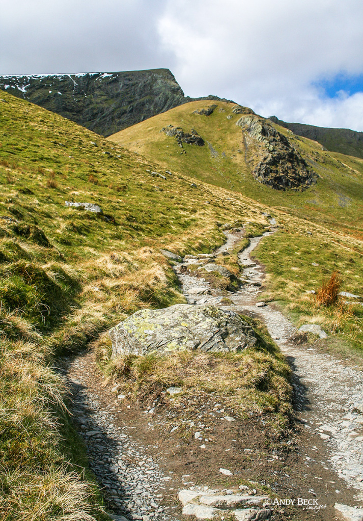
Sharp Edge, highlighted by the sun was where we were heading.
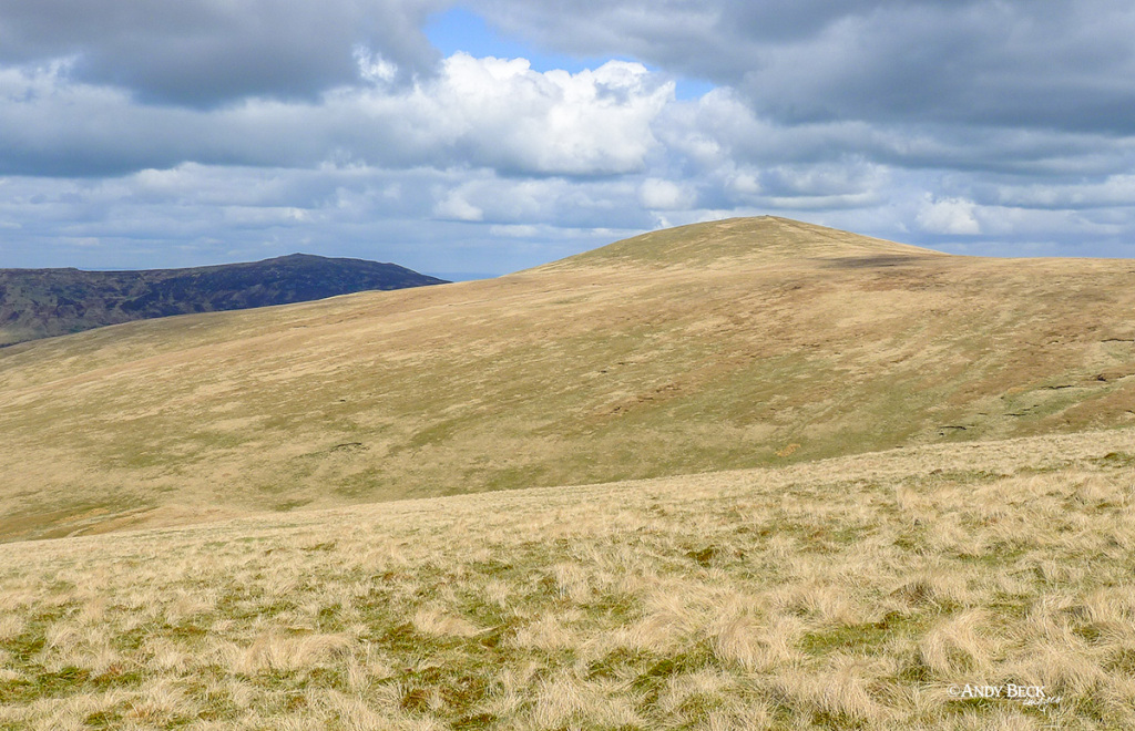
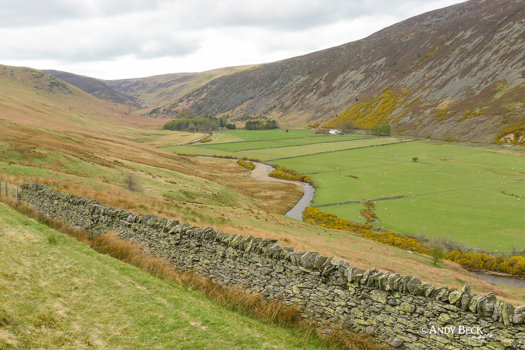
Passing over the col we took the well trodden path towards Brunt Knott, the rounded hill in the sun.
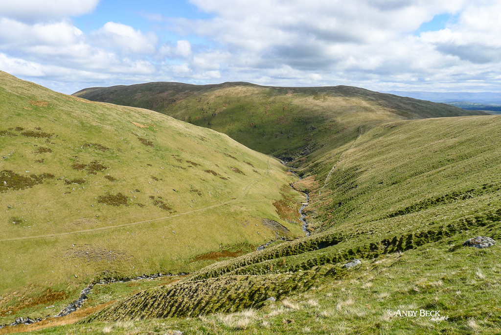
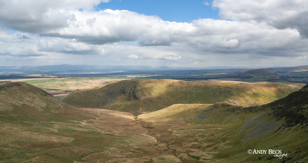
Down to our right is the Glenderamackin river and a look back to Souther Fell.
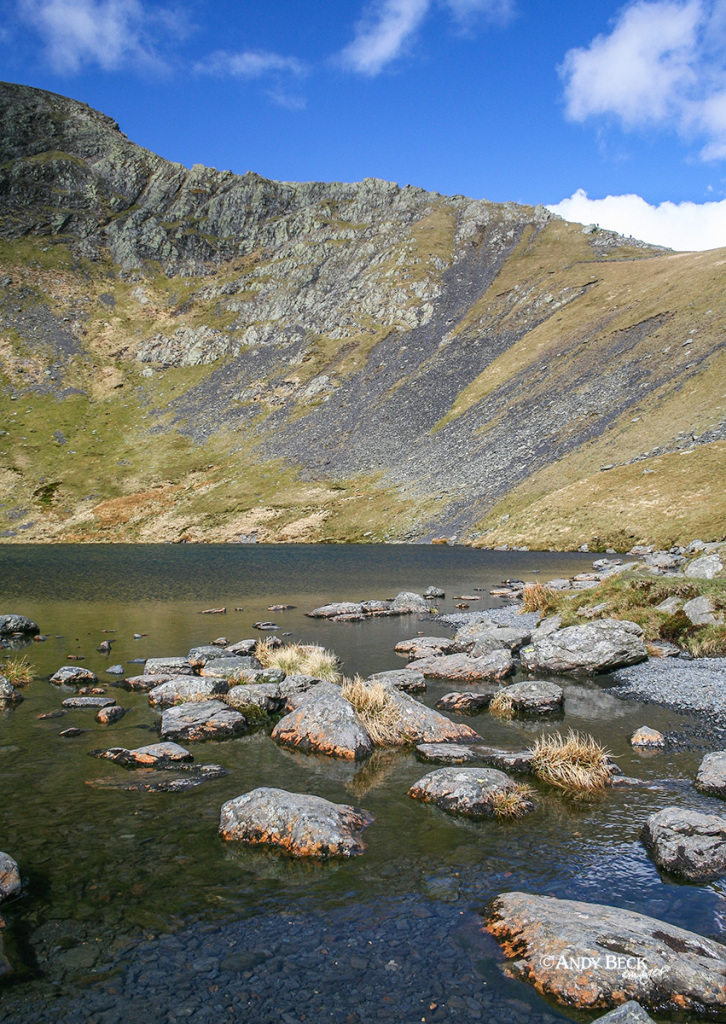
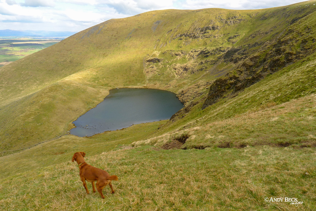
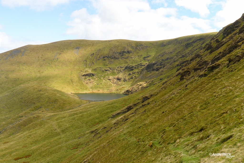
We soon reached Scales Tarn, hidden away below the steep slopes of Sharp Edge.
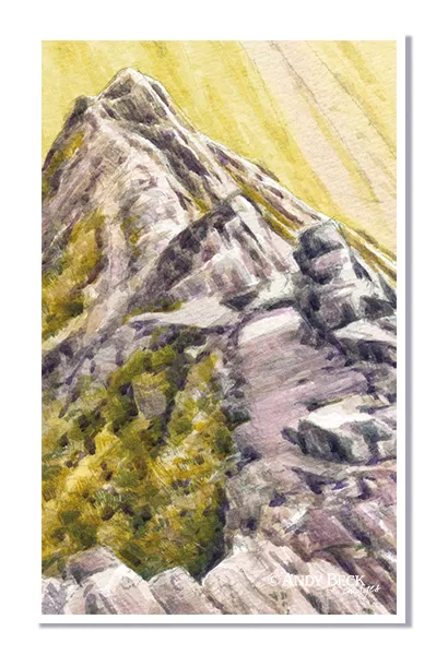
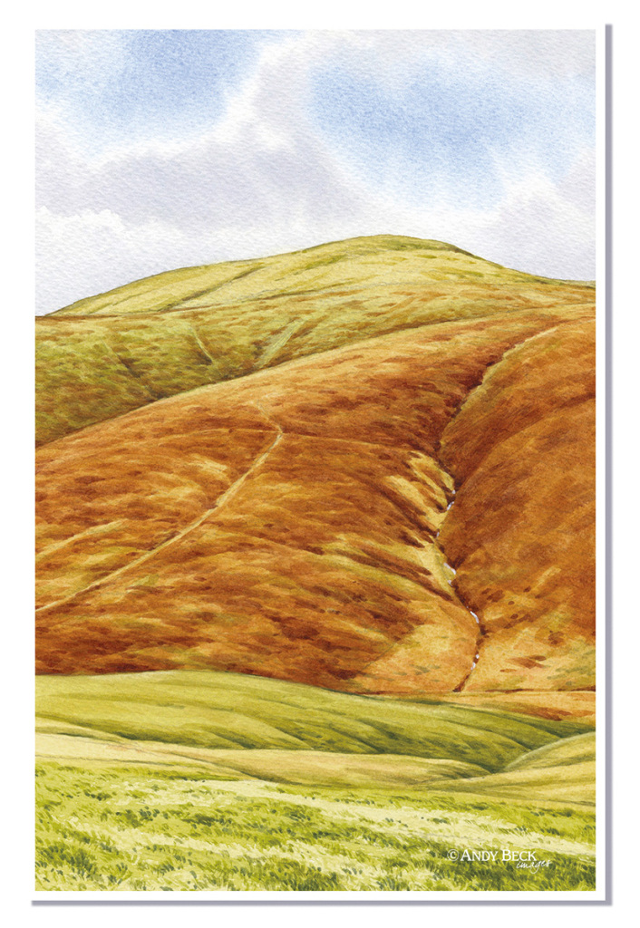
A steady ascent of the approach path to the ridge enabled me to obtain the reference photo for the next sketch.
Sketch from Blencathra page 26.
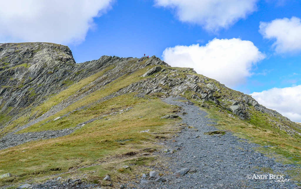
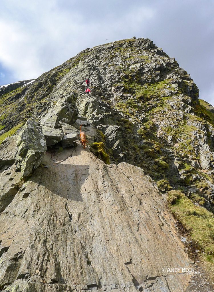
Soon the path changes to a rocky ridge, this is the start of Sharp Edge, reasonably easy and wide to begin.
Soon the ridge narrows to present more of a challenge. Generally the route is not too difficult, there are even trails down to the right here for a less exposed approach to the more difficult section. The section that proves challenging, mentioned by AW as “the awkward place”. In the above image it can just be seen behind Bailey*. The path here narrows and has become worn by thousands of boots. It can be very slippery in the wet. If you don’t feel confident in proceeding then now is the time to retire gracefully, there is no shame in that. Otherwise proceed with great care.
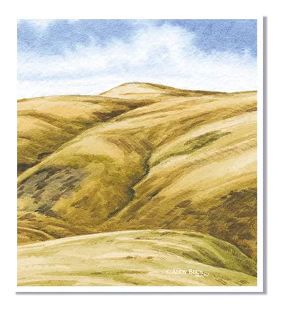
Looking back at the section we have just come along.
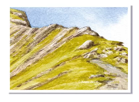
The sketch from the Wainwrights in Colour. Looking back at “the awkward place”.
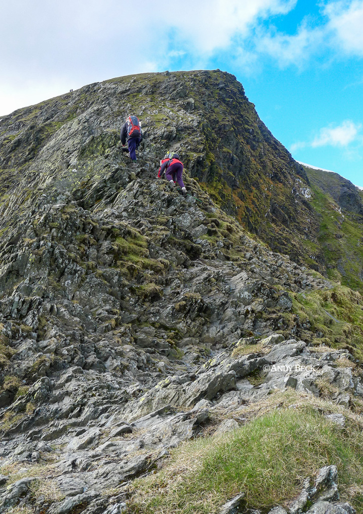
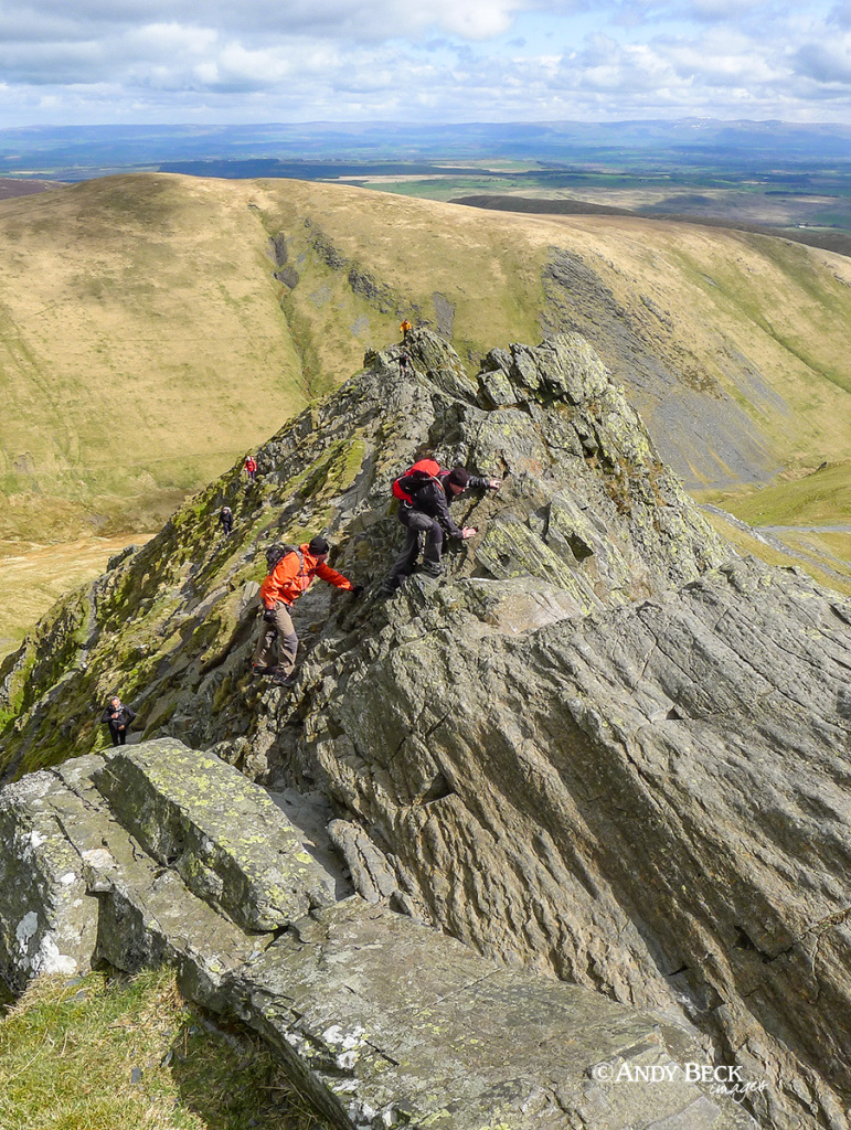
Sharp Edge as we ascend Foule Crag. Foule Crag can also be challenging, requiring “hands on” work and careful route finding amongst the shattered slate.
Nearing the top of the crag the path eases and you can give yourself a pat on the back.
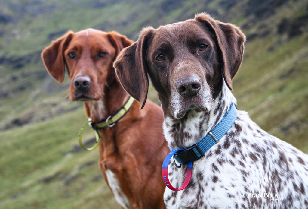
*Bailey and my other dogs were with me on every route for The Wainwrights in Colour. From the easy paths to the more challenging. I knew exactly what their limits were and I “trained” them for the more awkward sections by working up to the difficulties on less challenging routes. Sharp Edge is only a place to take a dog if you have a full understanding of their capabilities. My advice would be to treat them like you would a young child- keep a very close eye on them.
We reach the summit area of Blencathra. It would be easy to take walk up to the very top as these other people are doing but we had other places to be.
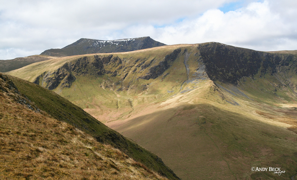
At the top of Foule Crag the remaining snow line leads the eye towards Bowscale Fell. We are not heading there just yet.
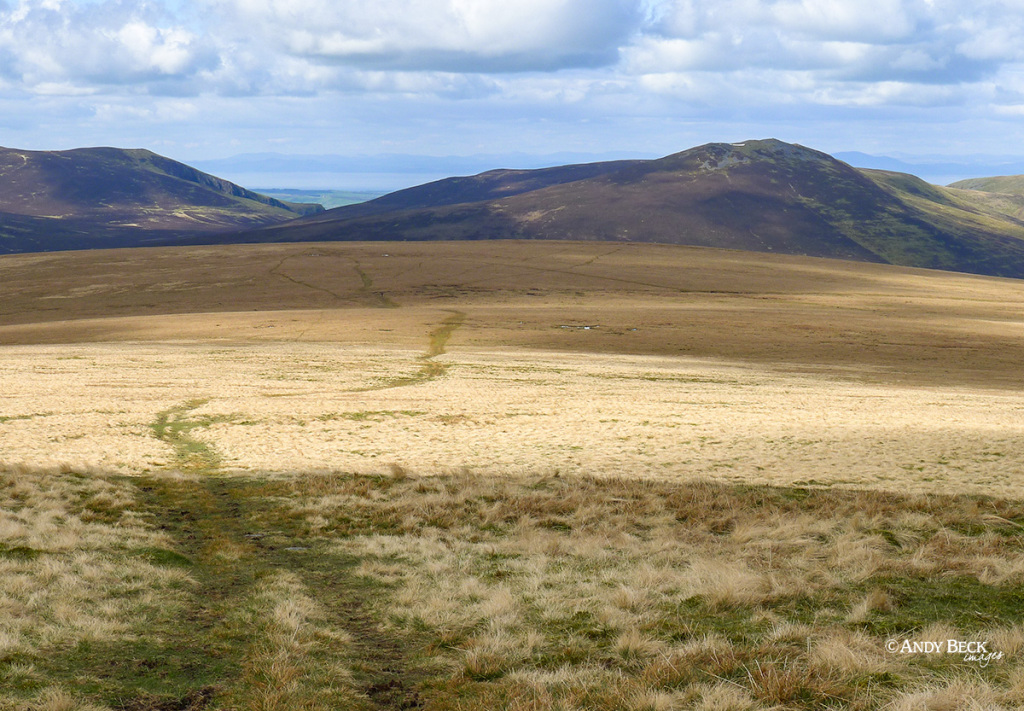
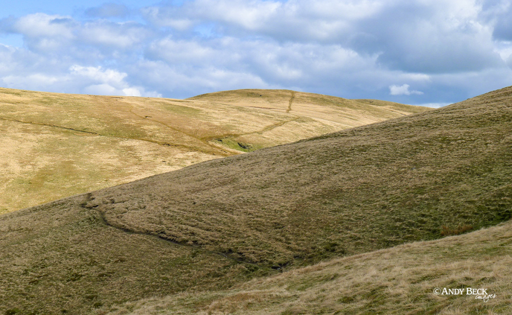
We are heading north west over the flatlands of Mungrisdale Common, following the obvious track to the top(?) of the fell.
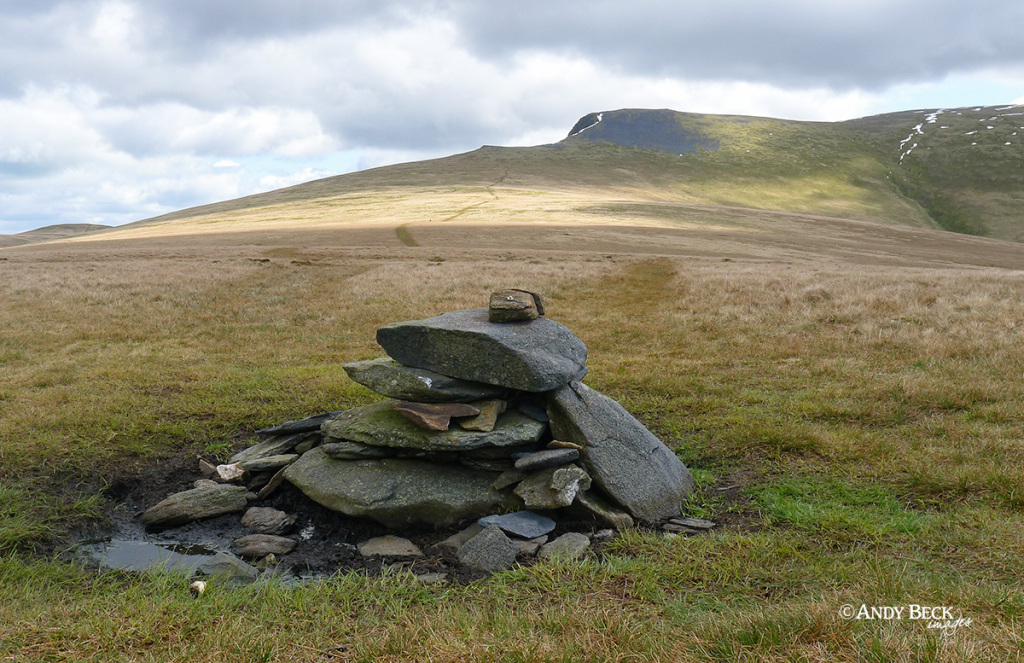
The cairn on what is now the recognised summit of Mungrisdale Common with the Skiddaw massif beyond.
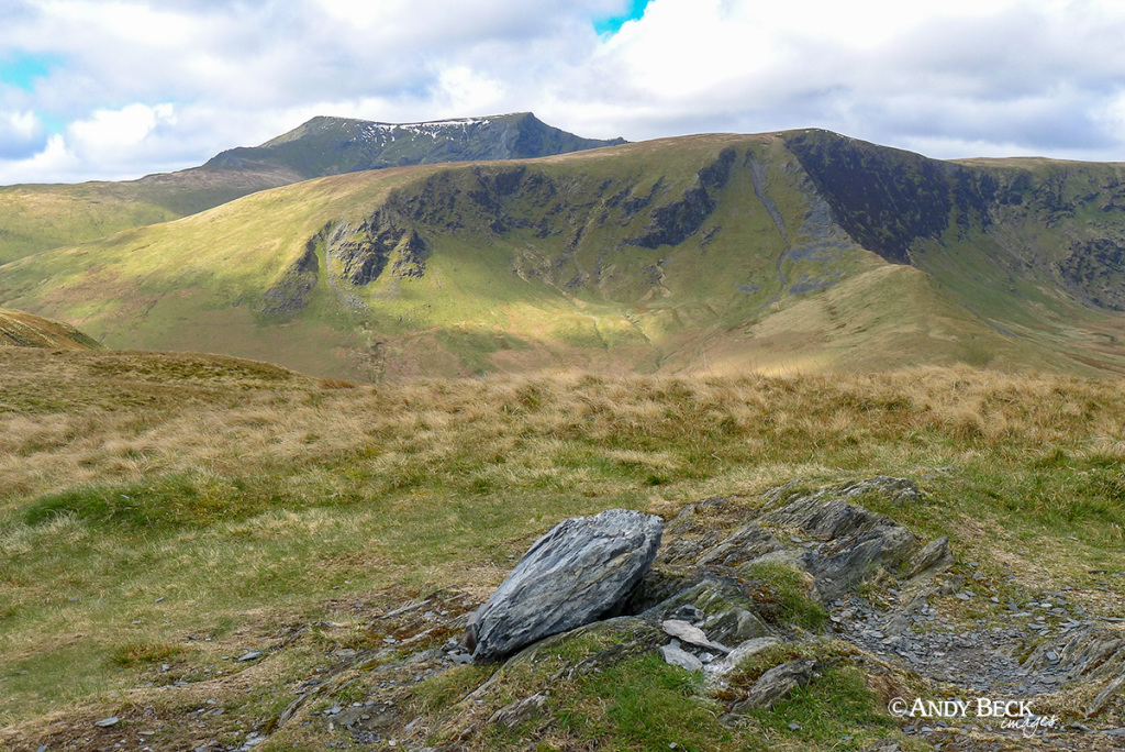
and looking back towards Foule Crag and the bare Blue Screes near the top.
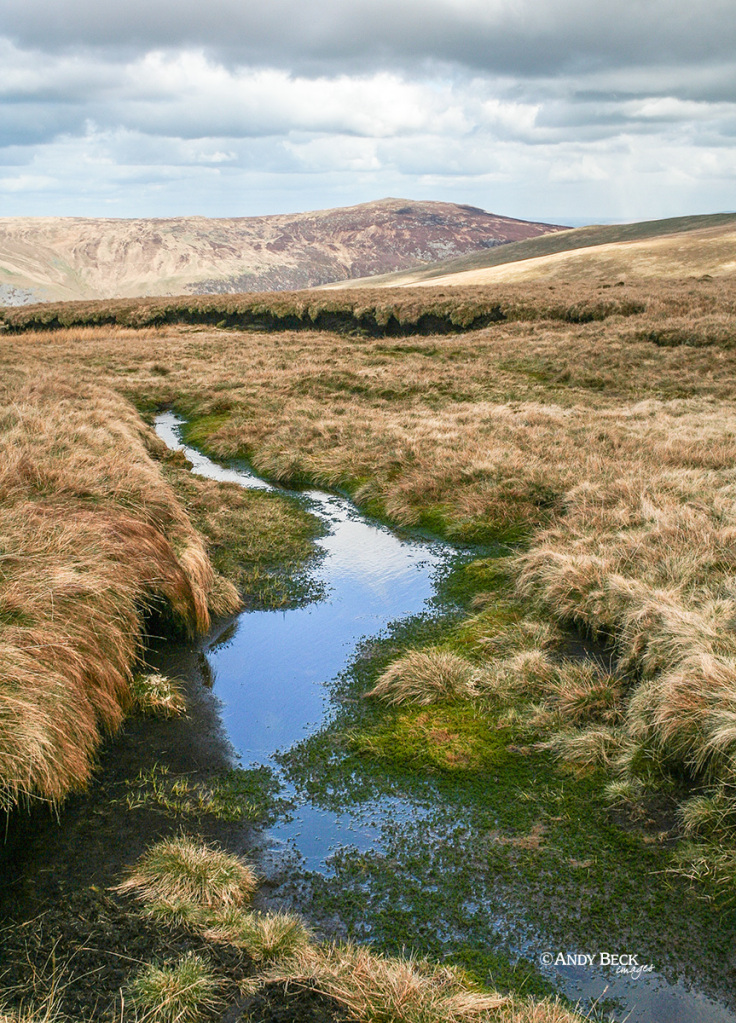
We left the summit area and headed off in the direction of Bannerdale Crags. Mungrisdale Common has a reputation for being flat, boring and a bit of a bog. Yes, whilst there are some areas of peaty bog like the one above, most of the flat summit area is just wet ground. You are not going to sink in up to your knees. It isn’t an issue if you are wearing a good pair of waterproof boots.
Heading east, we followed the path to the col at the head of Blackhazel Beck. The track leading up to Bannerdale Crags can be seen on the far hillside. That’s where we are heading now.
Directly to our north in the sunshine is the top of High Pike.
And nearer, to the north east is Bowscale Fell.
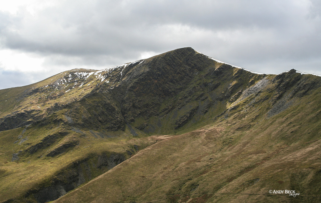
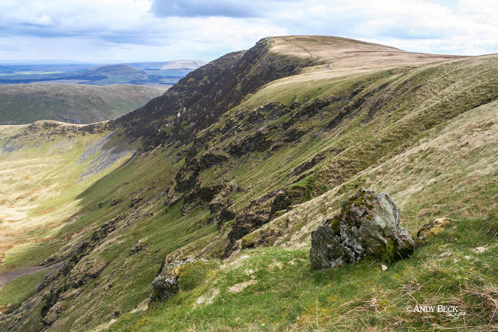
Heading to the top of Bannerdale Crags we get a good view of Foule Crag, Sharp Edge is hard to define from this angle.
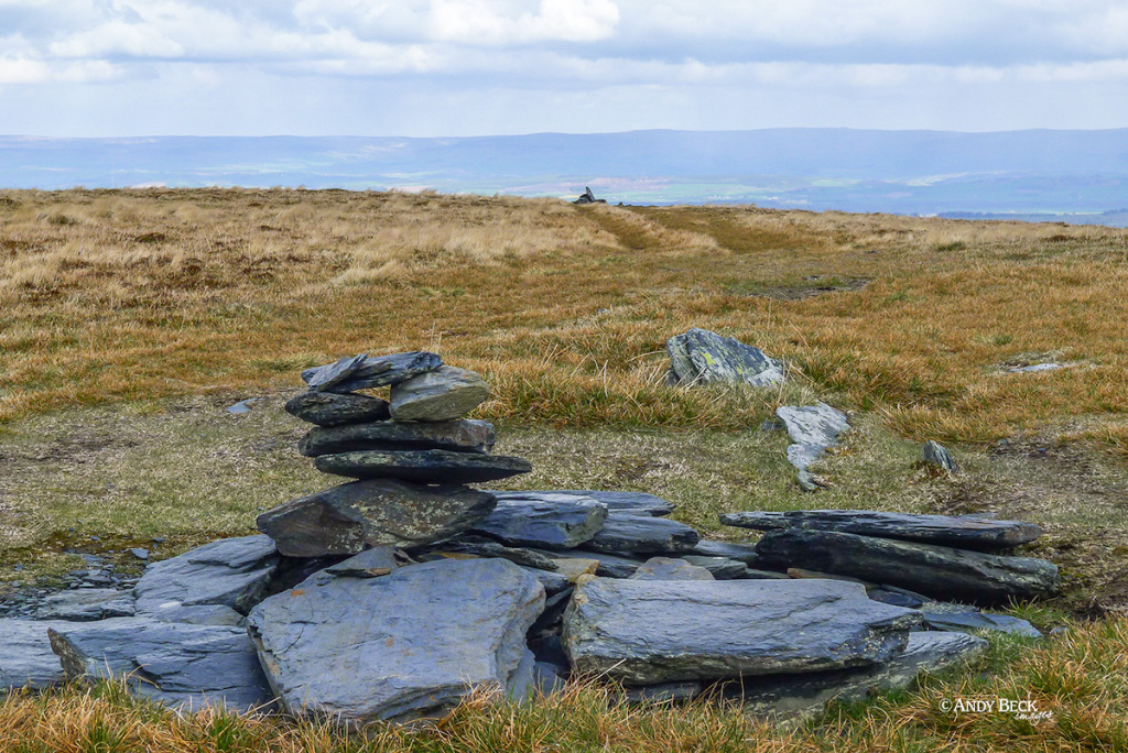
After a steady climb on a good path we soon arrive at the true summit of Bannerdale Crags, marked by a slate cairn. The Wainwright summit is in the distance. It is about 100m further on and nearer the steep drop.
The Wainwright summit of Bannerdale Crags, again, marked by a mound of slate and a short distance from the edge of the fell. We are going to follow the path around the top of the bowl of Bannerdale.
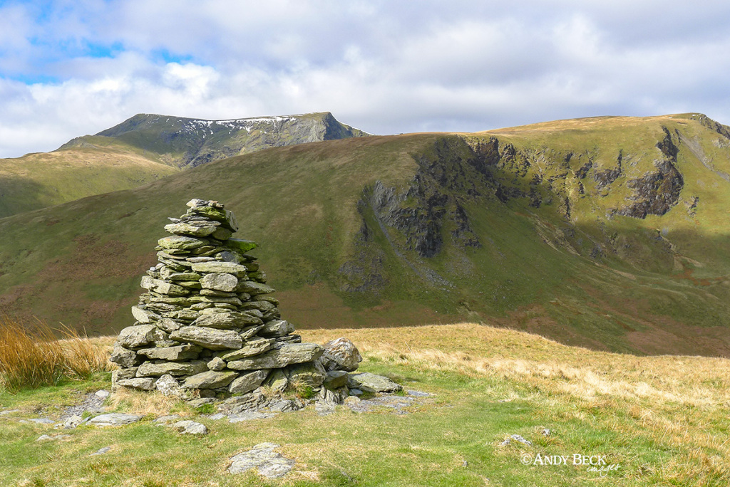
Soon we pass by the other currick mentioned by AW in his guide. There seems to be no exact definition of what a currick actually is apart from it being a pile of stones. Acting as a boundary or way marker seems to be the accepted explanation. A term particular to northern England.
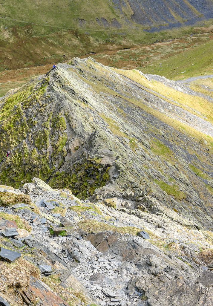
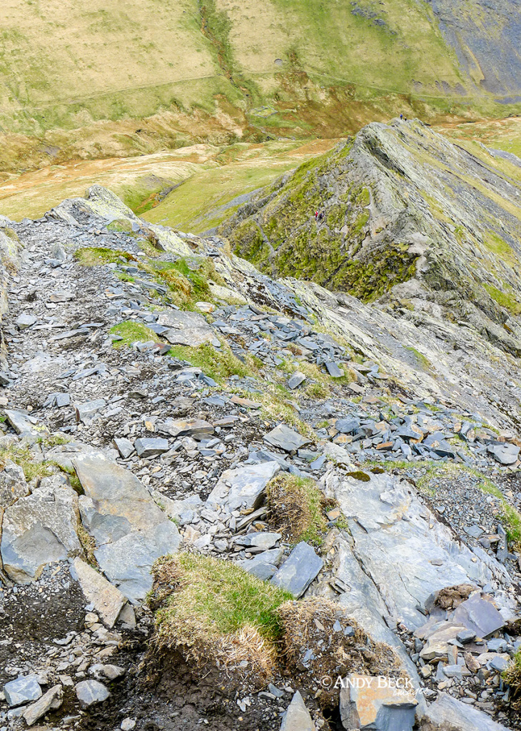
From the path on the edge we get an aerial view of Bannerdale and Souther Fell.
The route we have just travelled from Bannerdale Crags.
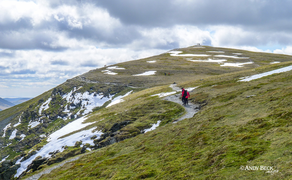
As we continued up to the heights of Bowscale Fell we passed this couple heading to Blencathra.
The low wind shelter on Bowscale Fell summit with Mungrisdale Common and Skiddaw
And looking more to the left at Blencathra.
Northwards, and a little walk from the summit, I was able to obtain the required view for the sketch of Knott.
As he often did, AW “squeezed” the fell to make if fit the page in the Pictorial Guide. As I was working to the same scale I had to do the same. I also added more colour to enhance the dull colours from my photograph. Knott 1.
Walking on towards Tarn Crags I was able to locate the position for the sketch “from Bowscale Fell” on the High Pike chapter page (1).
The sketch of High Pike “from Bowscale Fell”.
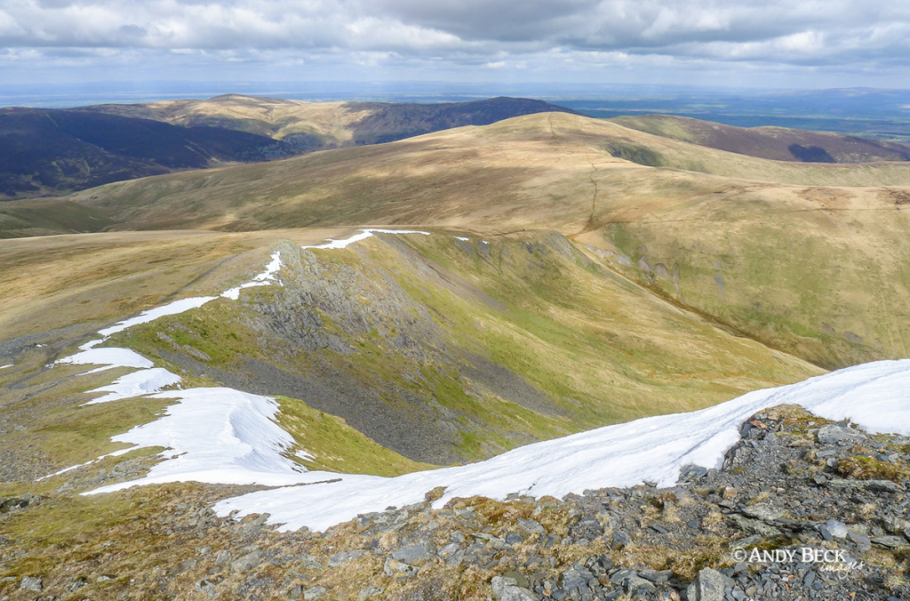
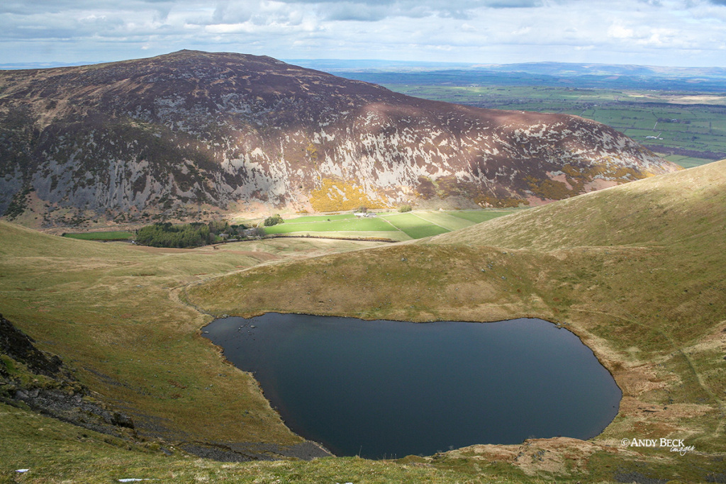
Looking down into the corrie of Bowscale Tarn. Carrock Fell forms the backdrop.
We were now descending off Bowscale Fell using the defined path into Mosedale.
From this angle the moraine that almost forms a wall below the tarn can easily be viewed.
My companions for the day. No signs of them tiring on this adventure.
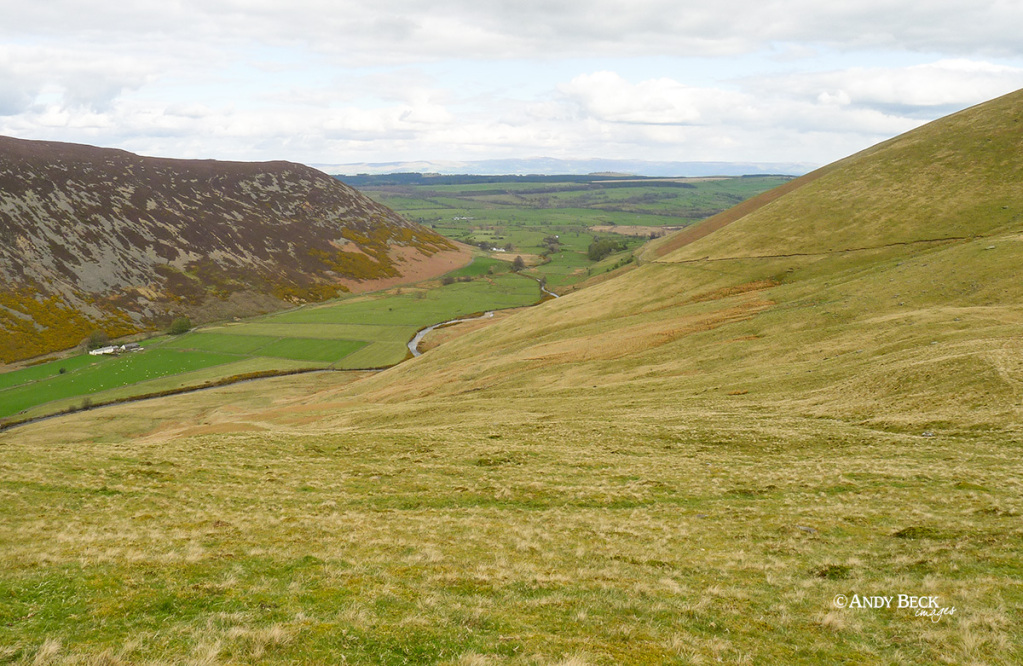
We soon lost altitude as we entered Mosedale. Following the path that contoured around the fellside we picked up the vehicle track that would take us back to Mungrisdale village.
Heading along the track out of the valley.
And looking back up the valley to the distant Great Lingy Hill. Once at the hamlet of Bowscale we followed the road back along to Mungrisdale .
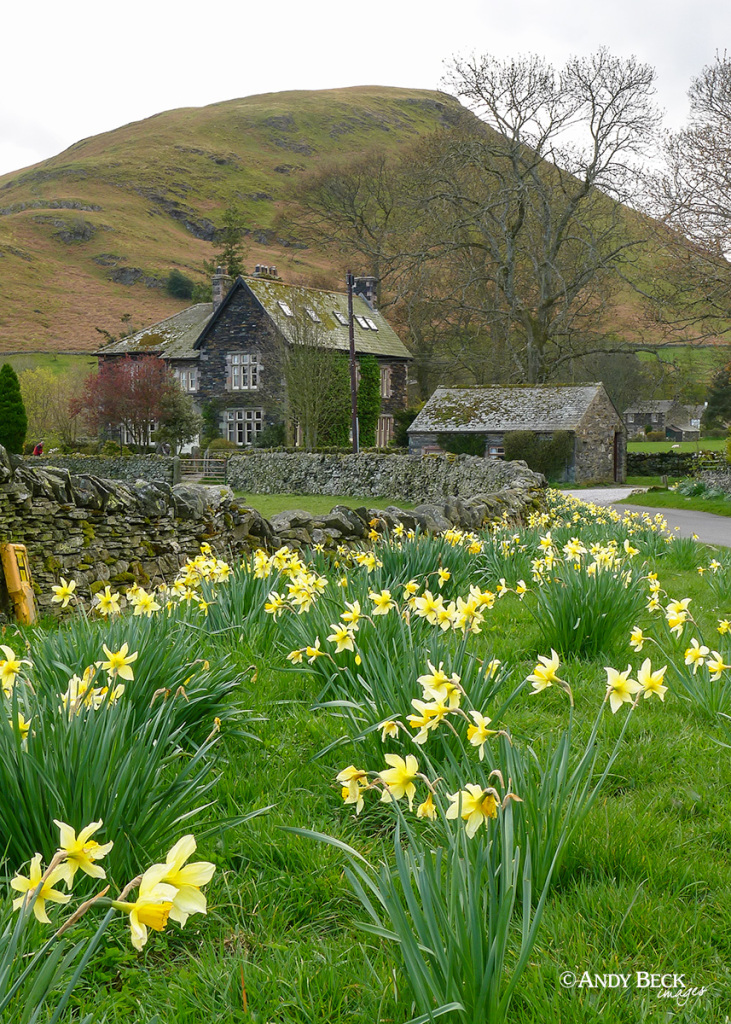
Daffodils greeted us as we entered the village, in the shelter of Souther Fell.
It certainly was a day of extremes, from the excitement of Sharp Edge to the flatlands of Mungrisdale Common. A good day out that enabled us not only to tick off several new fells for Bailey but also I was able to bag a few more references for the project.
I hope that you have enjoyed this post and perhaps it will inspire you to follow a similar path.
This website uses cookies to improve your experience. We'll assume you're ok with this, but you can opt-out if you wish.AcceptRejectRead More
Privacy & Cookies Policy
Privacy Overview
This website uses cookies to improve your experience while you navigate through the website. Out of these cookies, the cookies that are categorized as necessary are stored on your browser as they are essential for the working of basic functionalities of the website. We also use third-party cookies that help us analyze and understand how you use this website. These cookies will be stored in your browser only with your consent. You also have the option to opt-out of these cookies. But opting out of some of these cookies may have an effect on your browsing experience.
Necessary cookies are absolutely essential for the website to function properly. This category only includes cookies that ensures basic functionalities and security features of the website. These cookies do not store any personal information.
Any cookies that may not be particularly necessary for the website to function and is used specifically to collect user personal data via analytics, ads, other embedded contents are termed as non-necessary cookies. It is mandatory to procure user consent prior to running these cookies on your website.